


Garfield 20, Garfield County, Colorado
About
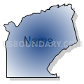
Outline

Summary
| Unique Area Identifier | 548220 |
| Name | Garfield 20 |
| County | Garfield County |
| State | Colorado |
| Area (square miles) | 101.87 |
| Land Area (square miles) | 101.20 |
| Water Area (square miles) | 0.68 |
| % of Land Area | 99.34 |
| % of Water Area | 0.66 |
| Latitude of the Internal Point | 39.46011600 |
| Longtitude of the Internal Point | -107.78779640 |
Maps


Graphs
Select a template below for downloading or customizing gragh for Garfield 20, Garfield County, Colorado


Neighbors
Neighoring Voting District (by Name) Neighboring Voting District on the Map
- Garfield 17, Garfield County, CO
- Garfield 19, Garfield County, CO
- Garfield 21, Garfield County, CO
- Garfield 22, Garfield County, CO
- Garfield 23, Garfield County, CO
- Garfield 24, Garfield County, CO
- Garfield 26, Garfield County, CO
- Mesa 82, Mesa County, CO
Top 10 Neighboring County Subdivision (by Population) Neighboring County Subdivision on the Map
- Rifle CCD, Garfield County, CO (13,236)
- New Castle CCD, Garfield County, CO (11,838)
- West Garfield CCD, Garfield County, CO (6,041)
- Collbran CCD, Mesa County, CO (2,490)
Top 10 Neighboring Place (by Population) Neighboring Place on the Map
Top 10 Neighboring Unified School District (by Population) Neighboring Unified School District on the Map
- Garfield School District RE-2, CO (25,009)
- Garfield County School District 16, CO (5,935)
- Plateau Valley School District 50, CO (2,572)
Top 10 Neighboring State Legislative District Lower Chamber (by Population) Neighboring State Legislative District Lower Chamber on the Map
- State House District 61, CO (79,637)
- State House District 55, CO (79,305)
- State House District 57, CO (78,537)
Top 10 Neighboring State Legislative District Upper Chamber (by Population) Neighboring State Legislative District Upper Chamber on the Map
Top 10 Neighboring 111th Congressional District (by Population) Neighboring 111th Congressional District on the Map
Top 10 Neighboring Census Tract (by Population) Neighboring Census Tract on the Map
- Census Tract 9520.02, Garfield County, CO (8,075)
- Census Tract 9521, Garfield County, CO (6,041)
- Census Tract 9520.01, Garfield County, CO (5,161)
- Census Tract 9519.01, Garfield County, CO (4,741)
- Census Tract 18, Mesa County, CO (3,424)