


El Paso 256, El Paso County, Colorado
About
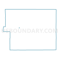
Outline

Summary
| Unique Area Identifier | 548008 |
| Name | El Paso 256 |
| County | El Paso County |
| State | Colorado |
| Area (square miles) | 0.12 |
| Land Area (square miles) | 0.12 |
| Water Area (square miles) | 0.00 |
| % of Land Area | 100.00 |
| % of Water Area | 0.00 |
| Latitude of the Internal Point | 38.85228610 |
| Longtitude of the Internal Point | -104.76110360 |
Maps


Graphs
Select a template below for downloading or customizing gragh for El Paso 256, El Paso County, Colorado


Neighbors
Neighoring Voting District (by Name) Neighboring Voting District on the Map
- El Paso 116, El Paso County, CO
- El Paso 120, El Paso County, CO
- El Paso 157, El Paso County, CO
- El Paso 18, El Paso County, CO
- El Paso 187, El Paso County, CO
- El Paso 29, El Paso County, CO
Top 10 Neighboring County Subdivision (by Population) Neighboring County Subdivision on the Map
Top 10 Neighboring Place (by Population) Neighboring Place on the Map
Top 10 Neighboring Unified School District (by Population) Neighboring Unified School District on the Map
Top 10 Neighboring State Legislative District Lower Chamber (by Population) Neighboring State Legislative District Lower Chamber on the Map
Top 10 Neighboring State Legislative District Upper Chamber (by Population) Neighboring State Legislative District Upper Chamber on the Map
Top 10 Neighboring 111th Congressional District (by Population) Neighboring 111th Congressional District on the Map
Top 10 Neighboring Census Tract (by Population) Neighboring Census Tract on the Map
- Census Tract 59, El Paso County, CO (6,573)
- Census Tract 20, El Paso County, CO (6,338)
- Census Tract 60, El Paso County, CO (6,188)