


Elbert 9, Elbert County, Colorado
About
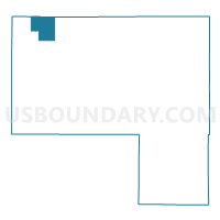
Outline

Summary
| Unique Area Identifier | 547757 |
| Name | Elbert 9 |
| County | Elbert County |
| State | Colorado |
| Area (square miles) | 31.06 |
| Land Area (square miles) | 31.06 |
| Water Area (square miles) | 0.00 |
| % of Land Area | 100.00 |
| % of Water Area | 0.00 |
| Latitude of the Internal Point | 39.52493300 |
| Longtitude of the Internal Point | -104.50788190 |
Maps


Graphs
Select a template below for downloading or customizing gragh for Elbert 9, Elbert County, Colorado


Neighbors
Neighoring Voting District (by Name) Neighboring Voting District on the Map
- Arapahoe 331, Arapahoe County, CO
- Elbert 15, Elbert County, CO
- Elbert 16, Elbert County, CO
- Elbert 17, Elbert County, CO
- Elbert 3, Elbert County, CO
- Elbert 7, Elbert County, CO
Top 10 Neighboring County Subdivision (by Population) Neighboring County Subdivision on the Map
Top 10 Neighboring Place (by Population) Neighboring Place on the Map
Top 10 Neighboring Unified School District (by Population) Neighboring Unified School District on the Map
- Douglas County School District RE-1, CO (287,725)
- Elizabeth School District C-1, CO (14,249)
- Bennett School District 29-J, CO (6,203)
- Kiowa School District C-2, CO (2,595)