


Douglas 1, Douglas County, Colorado
About
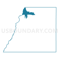
Outline

Summary
| Unique Area Identifier | 547651 |
| Name | Douglas 1 |
| County | Douglas County |
| State | Colorado |
| Area (square miles) | 20.25 |
| Land Area (square miles) | 18.99 |
| Water Area (square miles) | 1.27 |
| % of Land Area | 93.75 |
| % of Water Area | 6.25 |
| Latitude of the Internal Point | 39.51112620 |
| Longtitude of the Internal Point | -105.02706140 |
Maps


Graphs
Select a template below for downloading or customizing gragh for Douglas 1, Douglas County, Colorado


Neighbors
Neighoring Voting District (by Name) Neighboring Voting District on the Map
- 6222530013, Jefferson County, CO
- Douglas 139, Douglas County, CO
- Douglas 46, Douglas County, CO
- Douglas 47, Douglas County, CO
- Douglas 51, Douglas County, CO
- Douglas 53, Douglas County, CO
- Douglas 56, Douglas County, CO
- Douglas 57, Douglas County, CO
- Douglas 58, Douglas County, CO
- Douglas 59, Douglas County, CO
Top 10 Neighboring County Subdivision (by Population) Neighboring County Subdivision on the Map
Top 10 Neighboring Place (by Population) Neighboring Place on the Map
Top 10 Neighboring Unified School District (by Population) Neighboring Unified School District on the Map
- Jefferson County School District R-1, CO (537,431)
- Douglas County School District RE-1, CO (287,725)
Top 10 Neighboring State Legislative District Lower Chamber (by Population) Neighboring State Legislative District Lower Chamber on the Map
- State House District 44, CO (111,170)
- State House District 45, CO (110,234)
- State House District 43, CO (87,411)
- State House District 25, CO (72,603)
Top 10 Neighboring State Legislative District Upper Chamber (by Population) Neighboring State Legislative District Upper Chamber on the Map
- State Senate District 30, CO (188,625)
- State Senate District 4, CO (180,522)
- State Senate District 22, CO (127,842)
Top 10 Neighboring 111th Congressional District (by Population) Neighboring 111th Congressional District on the Map
Top 10 Neighboring Census Tract (by Population) Neighboring Census Tract on the Map
- Census Tract 141.37, Douglas County, CO (9,410)
- Census Tract 141.34, Douglas County, CO (5,897)
- Census Tract 141.24, Douglas County, CO (5,456)
- Census Tract 141.27, Douglas County, CO (5,220)
- Census Tract 120.36, Jefferson County, CO (3,707)
- Census Tract 141.31, Douglas County, CO (3,283)
- Census Tract 142.04, Douglas County, CO (3,188)
- Census Tract 141.35, Douglas County, CO (2,412)
- Census Tract 142.02, Douglas County, CO (1,845)
Top 10 Neighboring 5-Digit ZIP Code Tabulation Area (by Population) Neighboring 5-Digit ZIP Code Tabulation Area on the Map
- 80126, CO (39,698)
- 80128, CO (34,988)
- 80130, CO (27,054)
- 80129, CO (27,007)
- 80108, CO (22,612)
- 80125, CO (10,190)
- 80135, CO (3,833)