


Denver 139, Denver County, Colorado
About
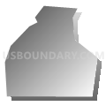
Outline

Summary
| Unique Area Identifier | 547531 |
| Name | Denver 139 |
| County | Denver County |
| State | Colorado |
| Area (square miles) | 0.16 |
| Land Area (square miles) | 0.16 |
| Water Area (square miles) | 0.00 |
| % of Land Area | 100.00 |
| % of Water Area | 0.00 |
| Latitude of the Internal Point | 39.62700200 |
| Longtitude of the Internal Point | -105.09855050 |
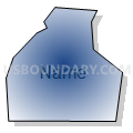
Maps


Graphs
Select a template below for downloading or customizing gragh for Denver 139, Denver County, Colorado


Neighbors
Neighoring Voting District (by Name) Neighboring Voting District on the Map
- 7222230004, Jefferson County, CO
- Denver 137, Denver County, CO
- Denver 138, Denver County, CO
- Denver 140, Denver County, CO