


Denver 333, Denver County, Colorado
About
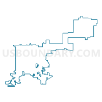
Outline

Summary
| Unique Area Identifier | 547469 |
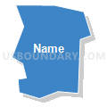
| Name | Denver 333 |
| County | Denver County |
| State | Colorado |
| Area (square miles) | 0.18 |
| Land Area (square miles) | 0.18 |
| Water Area (square miles) | 0.00 |
| % of Land Area | 100.00 |
| % of Water Area | 0.00 |
| Latitude of the Internal Point | 39.66392310 |
| Longtitude of the Internal Point | -104.95146030 |
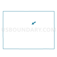
Maps

Graphs
Select a template below for downloading or customizing gragh for Denver 333, Denver County, Colorado


Neighbors
Neighoring Voting District (by Name) Neighboring Voting District on the Map
- Denver 327, Denver County, CO
- Denver 328, Denver County, CO
- Denver 332, Denver County, CO
- Denver 334, Denver County, CO
- Denver 337, Denver County, CO