


Bent 2, Bent County, Colorado
About
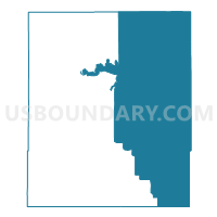
Outline

Summary
| Unique Area Identifier | 546796 |
| Name | Bent 2 |
| County | Bent County |
| State | Colorado |
| Area (square miles) | 633.48 |
| Land Area (square miles) | 613.70 |
| Water Area (square miles) | 19.78 |
| % of Land Area | 96.88 |
| % of Water Area | 3.12 |
| Latitude of the Internal Point | 37.97678450 |
| Longtitude of the Internal Point | -102.90317570 |
Maps


Graphs
Select a template below for downloading or customizing gragh for Bent 2, Bent County, Colorado


Neighbors
Neighoring Voting District (by Name) Neighboring Voting District on the Map
- Baca 3, Baca County, CO
- Bent 1, Bent County, CO
- Bent 3, Bent County, CO
- Bent 5, Bent County, CO
- Kiowa 2, Kiowa County, CO
- Kiowa 3, Kiowa County, CO
- Kiowa 4, Kiowa County, CO
- Prowers 11, Prowers County, CO
- Prowers 7, Prowers County, CO
- Prowers 8, Prowers County, CO
Top 10 Neighboring County Subdivision (by Population) Neighboring County Subdivision on the Map
- Lamar CCD, Prowers County, CO (10,067)
- Las Animas CCD, Bent County, CO (5,463)
- Eads CCD, Kiowa County, CO (890)
- McClave CCD, Bent County, CO (805)
- Pritchett CCD, Baca County, CO (310)
- Two Butte Creek CCD, Prowers County, CO (259)
- South Bent CCD, Bent County, CO (231)
- Haswell CCD, Kiowa County, CO (115)
Top 10 Neighboring Place (by Population) Neighboring Place on the Map
Top 10 Neighboring Unified School District (by Population) Neighboring Unified School District on the Map
- Lamar School District RE-2, CO (9,397)
- Las Animas School District RE-1, CO (5,619)
- Springfield School District RE-4, CO (1,998)
- Eads School District RE-1, CO (1,103)
- Wiley School District RE-13-JT, CO (965)
- McClave School District RE-2, CO (732)
- Pritchett School District RE-3, CO (303)
Top 10 Neighboring State Legislative District Lower Chamber (by Population) Neighboring State Legislative District Lower Chamber on the Map
Top 10 Neighboring State Legislative District Upper Chamber (by Population) Neighboring State Legislative District Upper Chamber on the Map
Top 10 Neighboring 111th Congressional District (by Population) Neighboring 111th Congressional District on the Map
Top 10 Neighboring Census Tract (by Population) Neighboring Census Tract on the Map
- Census Tract 9667, Bent County, CO (6,499)
- Census Tract 7, Prowers County, CO (2,220)
- Census Tract 9646, Baca County, CO (1,738)
- Census Tract 1, Prowers County, CO (1,462)
- Census Tract 9601, Kiowa County, CO (1,398)
Top 10 Neighboring 5-Digit ZIP Code Tabulation Area (by Population) Neighboring 5-Digit ZIP Code Tabulation Area on the Map
- 81052, CO (9,534)
- 81054, CO (5,134)
- 81073, CO (1,932)
- 81036, CO (962)
- 81092, CO (865)
- 81057, CO (418)
- 81044, CO (224)