


Baca 3, Baca County, Colorado
About
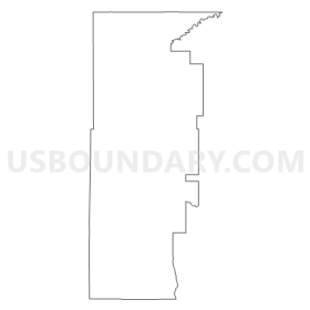
Outline
Summary
| Unique Area Identifier | 546789 |
| Name | Baca 3 |
| County | Baca County |
| State | Colorado |
| Area (square miles) | 685.74 |
| Land Area (square miles) | 685.66 |
| Water Area (square miles) | 0.08 |
| % of Land Area | 99.99 |
| % of Water Area | 0.01 |
| Latitude of the Internal Point | 37.33396500 |
| Longtitude of the Internal Point | -102.93865170 |
Maps


Graphs
Select a template below for downloading or customizing gragh for Baca 3, Baca County, Colorado


Neighbors
Neighoring Voting District (by Name) Neighboring Voting District on the Map
- Voting District 2, Cimarron County, OK
- Voting District 3, Cimarron County, OK
- Baca 4, Baca County, CO
- Baca 6, Baca County, CO
- Baca 7, Baca County, CO
- Bent 2, Bent County, CO
- Bent 5, Bent County, CO
- Las Animas 1, Las Animas County, CO
- Prowers 8, Prowers County, CO
- Union County Precinct 4, Union County, NM
Top 10 Neighboring County Subdivision (by Population) Neighboring County Subdivision on the Map
- Springfield CCD, Baca County, CO (2,050)
- Boise City CCD, Cimarron County, OK (1,882)
- Clayton North CCD, Union County, NM (819)
- Campo CCD, Baca County, CO (328)
- Kim CCD, Las Animas County, CO (311)
- Pritchett CCD, Baca County, CO (310)
- Two Butte Creek CCD, Prowers County, CO (259)
- South Bent CCD, Bent County, CO (231)
Top 10 Neighboring Place (by Population) Neighboring Place on the Map
Top 10 Neighboring Unified School District (by Population) Neighboring Unified School District on the Map
- Lamar School District RE-2, CO (9,397)
- Las Animas School District RE-1, CO (5,619)
- Clayton Public Schools, NM (3,976)
- Springfield School District RE-4, CO (1,998)
- Boise City Public Schools, OK (1,570)
- McClave School District RE-2, CO (732)
- Kim Reorganized School District 88, CO (308)
- Pritchett School District RE-3, CO (303)
- Campo School District RE-6, CO (254)
Top 10 Neighboring State Legislative District Lower Chamber (by Population) Neighboring State Legislative District Lower Chamber on the Map
- State House District 64, CO (63,179)
- State House District 61, OK (34,098)
- State House District 67, NM (25,041)
Top 10 Neighboring State Legislative District Upper Chamber (by Population) Neighboring State Legislative District Upper Chamber on the Map
- State Senate District 2, CO (125,412)
- State Senate District 1, CO (125,154)
- State Senate District 27, OK (72,228)
- State Senate District 7, NM (42,634)
Top 10 Neighboring 111th Congressional District (by Population) Neighboring 111th Congressional District on the Map
- Congressional District 3, OK (732,394)
- Congressional District 4, CO (725,041)
- Congressional District 3, CO (706,186)
- Congressional District 3, NM (693,284)
Top 10 Neighboring Census Tract (by Population) Neighboring Census Tract on the Map
- Census Tract 9667, Bent County, CO (6,499)
- Census Tract 9502, Union County, NM (4,549)
- Census Tract 8, Las Animas County, CO (2,766)
- Census Tract 7, Prowers County, CO (2,220)
- Census Tract 9647, Baca County, CO (2,050)
- Census Tract 9646, Baca County, CO (1,738)
- Census Tract 9501, Cimarron County, OK (1,163)
Top 10 Neighboring 5-Digit ZIP Code Tabulation Area (by Population) Neighboring 5-Digit ZIP Code Tabulation Area on the Map
- 81052, CO (9,534)
- 81054, CO (5,134)
- 81073, CO (1,932)
- 81029, CO (326)
- 81049, CO (289)
- 81064, CO (282)
- 88419, NM (229)
- 81044, CO (224)
- 73946, OK (45)