


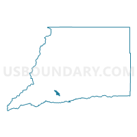
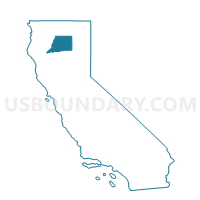
Voting District 20165, Shasta County, California
About
Outline

Summary
| Unique Area Identifier | 544254 |
| Name | Voting District 20165 |
| County | Shasta County |
| State | California |
| Area (square miles) | 5.53 |
| Land Area (square miles) | 5.47 |
| Water Area (square miles) | 0.05 |
| % of Land Area | 99.01 |
| % of Water Area | 0.99 |
| Latitude of the Internal Point | 40.47486720 |
| Longtitude of the Internal Point | -122.35229500 |
Maps

Graphs
Select a template below for downloading or customizing gragh for Voting District 20165, Shasta County, California


Neighbors
Neighoring Voting District (by Name) Neighboring Voting District on the Map
- Voting District 20070, Shasta County, CA
- Voting District 20081, Shasta County, CA
- Voting District 20115, Shasta County, CA
- Voting District 20135, Shasta County, CA
- Voting District 20170, Shasta County, CA
- Voting District 20175, Shasta County, CA
- Voting District 50415, Shasta County, CA
- Voting District 50435, Shasta County, CA
- Voting District 50455, Shasta County, CA
- Voting District 50460, Shasta County, CA
Top 10 Neighboring County Subdivision (by Population) Neighboring County Subdivision on the Map
Top 10 Neighboring Place (by Population) Neighboring Place on the Map
Top 10 Neighboring Elementary School District (by Population) Neighboring Elementary School District on the Map
- Redding Elementary School District, CA (34,977)
- Cascade Union Elementary School District, CA (15,088)
- Happy Valley Union Elementary School District, CA (6,002)
Top 10 Neighboring Secondary School District (by Population) Neighboring Secondary School District on the Map
Top 10 Neighboring State Legislative District Lower Chamber (by Population) Neighboring State Legislative District Lower Chamber on the Map
Top 10 Neighboring State Legislative District Upper Chamber (by Population) Neighboring State Legislative District Upper Chamber on the Map
Top 10 Neighboring 111th Congressional District (by Population) Neighboring 111th Congressional District on the Map
Top 10 Neighboring Census Tract (by Population) Neighboring Census Tract on the Map
- Census Tract 123.02, Shasta County, CA (5,450)
- Census Tract 110.02, Shasta County, CA (5,324)
- Census Tract 120, Shasta County, CA (4,648)
- Census Tract 121.01, Shasta County, CA (4,505)
- Census Tract 111, Shasta County, CA (3,096)
- Census Tract 123.01, Shasta County, CA (2,578)
- Census Tract 110.01, Shasta County, CA (1,668)