


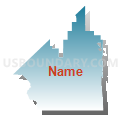
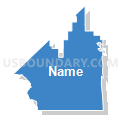
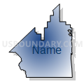
Voting District 20625, Kings County, California
About
Outline

Summary
| Unique Area Identifier | 532480 |
| Name | Voting District 20625 |
| County | Kings County |
| State | California |
| Area (square miles) | 278.48 |
| Land Area (square miles) | 278.25 |
| Water Area (square miles) | 0.23 |
| % of Land Area | 99.92 |
| % of Water Area | 0.08 |
| Latitude of the Internal Point | 35.91320280 |
| Longtitude of the Internal Point | -120.08213770 |
Maps


Graphs
Select a template below for downloading or customizing gragh for Voting District 20625, Kings County, California


Neighbors
Neighoring Voting District (by Name) Neighboring Voting District on the Map
- Voting District 10010, San Luis Obispo County, CA
- Voting District 20175, Kings County, CA
- Voting District 20615, Kings County, CA
- Voting District 20616, Kings County, CA
- Voting District 20620, Kings County, CA
- Voting District 20630, Kings County, CA
- Voting District 20635, Kings County, CA
- Voting District 30940, Monterey County, CA
- Voting District 40000, Kern County, CA
- Voting District 40025, Kern County, CA
- Voting District 42870, Fresno County, CA
- Voting District 42875, Fresno County, CA
Top 10 Neighboring County Subdivision (by Population) Neighboring County Subdivision on the Map
- Paso Robles CCD, San Luis Obispo County, CA (49,131)
- Wasco CCD, Kern County, CA (29,808)
- Coalinga CCD, Fresno County, CA (19,362)
- Stratford CCD, Kings County, CA (16,634)
- Avenal CCD, Kings County, CA (15,565)
- Huron CCD, Fresno County, CA (7,991)
- San Ardo CCD, Monterey County, CA (3,778)
Top 10 Neighboring Place (by Population) Neighboring Place on the Map
Top 10 Neighboring Elementary School District (by Population) Neighboring Elementary School District on the Map
Top 10 Neighboring Secondary School District (by Population) Neighboring Secondary School District on the Map
Top 10 Neighboring Unified School District (by Population) Neighboring Unified School District on the Map
- Coalinga-Huron Joint Unified School District, CA (26,275)
- Reef-Sunset Unified School District, CA (17,222)
- Shandon Joint Unified School District, CA (1,859)
Top 10 Neighboring State Legislative District Lower Chamber (by Population) Neighboring State Legislative District Lower Chamber on the Map
- Assembly District 30, CA (504,729)
- Assembly District 33, CA (469,458)
- Assembly District 28, CA (462,750)
Top 10 Neighboring State Legislative District Upper Chamber (by Population) Neighboring State Legislative District Upper Chamber on the Map
Top 10 Neighboring 111th Congressional District (by Population) Neighboring 111th Congressional District on the Map
- Congressional District 22, CA (797,084)
- Congressional District 20, CA (744,350)
- Congressional District 17, CA (664,240)
Top 10 Neighboring Census Tract (by Population) Neighboring Census Tract on the Map
- Census Tract 103, San Luis Obispo County, CA (10,043)
- Census Tract 17.01, Kings County, CA (9,142)
- Census Tract 9818, Kings County, CA (6,423)
- Census Tract 16.01, Kings County, CA (4,516)
- Census Tract 45, Kern County, CA (3,937)
- Census Tract 114, Monterey County, CA (3,778)
- Census Tract 79.02, Fresno County, CA (2,742)
- Census Tract 78.01, Fresno County, CA (2,722)
Top 10 Neighboring 5-Digit ZIP Code Tabulation Area (by Population) Neighboring 5-Digit ZIP Code Tabulation Area on the Map
- 93210, CA (19,504)
- 93204, CA (15,529)
- 93234, CA (6,987)
- 93451, CA (3,779)
- 93249, CA (2,739)
- 93239, CA (1,688)
- 93461, CA (1,623)