


Voting District 10820, Kern County, California
About
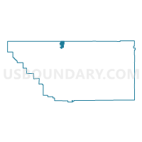
Outline

Summary
| Unique Area Identifier | 531996 |
| Name | Voting District 10820 |
| County | Kern County |
| State | California |
| Area (square miles) | 26.12 |
| Land Area (square miles) | 26.03 |
| Water Area (square miles) | 0.09 |
| % of Land Area | 99.66 |
| % of Water Area | 0.34 |
| Latitude of the Internal Point | 35.74091970 |
| Longtitude of the Internal Point | -119.09265780 |
Maps


Graphs
Select a template below for downloading or customizing gragh for Voting District 10820, Kern County, California


Neighbors
Neighoring Voting District (by Name) Neighboring Voting District on the Map
- Voting District 10035, Kern County, CA
- Voting District 10040, Kern County, CA
- Voting District 10085, Kern County, CA
- Voting District 10740, Kern County, CA
- Voting District 10815, Kern County, CA
- Voting District 10830, Kern County, CA
- Voting District 10910, Kern County, CA
- Voting District 21615, Tulare County, CA
- Voting District 54385, Tulare County, CA
- Voting District 54480, Tulare County, CA
- Voting District 55435, Tulare County, CA
Top 10 Neighboring County Subdivision (by Population) Neighboring County Subdivision on the Map
- Delano-McFarland CCD, Kern County, CA (68,758)
- Lake Isabella CCD, Kern County, CA (16,234)
- Earlimart CCD, Tulare County, CA (15,152)
- Terra Bella CCD, Tulare County, CA (6,628)
Top 10 Neighboring Place (by Population) Neighboring Place on the Map
Top 10 Neighboring Elementary School District (by Population) Neighboring Elementary School District on the Map
- Delano Union Elementary School District, CA (54,938)
- Richgrove Elementary School District, CA (3,249)
- Ducor Union Elementary School District, CA (1,276)
Top 10 Neighboring Secondary School District (by Population) Neighboring Secondary School District on the Map
- Delano Joint Union High School District, CA (70,221)
- Porterville Unified (9-12) School District, CA (47,072)
Top 10 Neighboring Unified School District (by Population) Neighboring Unified School District on the Map
Top 10 Neighboring State Legislative District Lower Chamber (by Population) Neighboring State Legislative District Lower Chamber on the Map
- Assembly District 32, CA (547,084)
- Assembly District 30, CA (504,729)
- Assembly District 34, CA (487,193)
Top 10 Neighboring State Legislative District Upper Chamber (by Population) Neighboring State Legislative District Upper Chamber on the Map
Top 10 Neighboring 111th Congressional District (by Population) Neighboring 111th Congressional District on the Map
Top 10 Neighboring Census Tract (by Population) Neighboring Census Tract on the Map
- Census Tract 46.04, Kern County, CA (15,845)
- Census Tract 43, Tulare County, CA (7,682)
- Census Tract 45, Tulare County, CA (6,628)
- Census Tract 52.01, Kern County, CA (5,397)