


Voting District 50775, Kern County, California
About
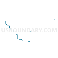
Outline

Summary
| Unique Area Identifier | 531981 |
| Name | Voting District 50775 |
| County | Kern County |
| State | California |
| Area (square miles) | 2.89 |
| Land Area (square miles) | 2.89 |
| Water Area (square miles) | 0.00 |
| % of Land Area | 100.00 |
| % of Water Area | 0.00 |
| Latitude of the Internal Point | 35.20663120 |
| Longtitude of the Internal Point | -118.84931920 |
Maps


Graphs
Select a template below for downloading or customizing gragh for Voting District 50775, Kern County, California


Neighbors
Neighoring Voting District (by Name) Neighboring Voting District on the Map
- Voting District 50165, Kern County, CA
- Voting District 50175, Kern County, CA
- Voting District 50180, Kern County, CA
- Voting District 50780, Kern County, CA
- Voting District 50785, Kern County, CA
- Voting District 50800, Kern County, CA
- Voting District 50805, Kern County, CA
- Voting District 50825, Kern County, CA
- Voting District 50830, Kern County, CA
- Voting District 50835, Kern County, CA
- Voting District 50840, Kern County, CA
- Voting District 50860, Kern County, CA
Top 10 Neighboring County Subdivision (by Population) Neighboring County Subdivision on the Map
Top 10 Neighboring Place (by Population) Neighboring Place on the Map
Top 10 Neighboring Elementary School District (by Population) Neighboring Elementary School District on the Map
- Arvin Union Elementary School District, CA (19,762)
- Vineland Elementary School District, CA (4,205)
- Di Giorgio Elementary School District, CA (918)
Top 10 Neighboring Secondary School District (by Population) Neighboring Secondary School District on the Map
Top 10 Neighboring State Legislative District Lower Chamber (by Population) Neighboring State Legislative District Lower Chamber on the Map
Top 10 Neighboring State Legislative District Upper Chamber (by Population) Neighboring State Legislative District Upper Chamber on the Map
Top 10 Neighboring 111th Congressional District (by Population) Neighboring 111th Congressional District on the Map
Top 10 Neighboring Census Tract (by Population) Neighboring Census Tract on the Map
- Census Tract 63.03, Kern County, CA (6,784)
- Census Tract 62.02, Kern County, CA (6,401)
- Census Tract 63.01, Kern County, CA (4,004)