


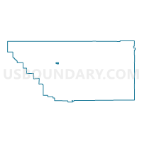
Voting District 10330, Kern County, California
About
Outline

Summary
| Unique Area Identifier | 531899 |
| Name | Voting District 10330 |
| County | Kern County |
| State | California |
| Area (square miles) | 4.00 |
| Land Area (square miles) | 4.00 |
| Water Area (square miles) | 0.00 |
| % of Land Area | 100.00 |
| % of Water Area | 0.00 |
| Latitude of the Internal Point | 35.43160600 |
| Longtitude of the Internal Point | -119.18755330 |
Maps


Graphs
Select a template below for downloading or customizing gragh for Voting District 10330, Kern County, California


Neighbors
Neighoring Voting District (by Name) Neighboring Voting District on the Map
- Voting District 10270, Kern County, CA
- Voting District 10275, Kern County, CA
- Voting District 10305, Kern County, CA
- Voting District 10325, Kern County, CA
- Voting District 10335, Kern County, CA
- Voting District 10380, Kern County, CA
- Voting District 10385, Kern County, CA
- Voting District 40400, Kern County, CA
- Voting District 40410, Kern County, CA
- Voting District 40905, Kern County, CA
Top 10 Neighboring County Subdivision (by Population) Neighboring County Subdivision on the Map
Top 10 Neighboring Place (by Population) Neighboring Place on the Map
Top 10 Neighboring Elementary School District (by Population) Neighboring Elementary School District on the Map
- Rosedale Union Elementary School District, CA (44,186)
- Norris Elementary School District, CA (23,935)
- Rio Bravo-Greeley Union Elementary School District, CA (4,787)