


Voting District 10880, Kern County, California
About
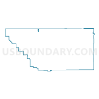
Outline

Summary
| Unique Area Identifier | 531862 |
| Name | Voting District 10880 |
| County | Kern County |
| State | California |
| Area (square miles) | 3.11 |
| Land Area (square miles) | 3.11 |
| Water Area (square miles) | 0.00 |
| % of Land Area | 100.00 |
| % of Water Area | 0.00 |
| Latitude of the Internal Point | 35.75047350 |
| Longtitude of the Internal Point | -119.23601750 |
Maps


Graphs
Select a template below for downloading or customizing gragh for Voting District 10880, Kern County, California


Neighbors
Neighoring Voting District (by Name) Neighboring Voting District on the Map
- Voting District 10745, Kern County, CA
- Voting District 10805, Kern County, CA
- Voting District 10825, Kern County, CA
- Voting District 10850, Kern County, CA
- Voting District 10855, Kern County, CA
- Voting District 10860, Kern County, CA
- Voting District 10875, Kern County, CA
- Voting District 10890, Kern County, CA
- Voting District 10891, Kern County, CA
- Voting District 10895, Kern County, CA
- Voting District 10900, Kern County, CA
Top 10 Neighboring County Subdivision (by Population) Neighboring County Subdivision on the Map
Top 10 Neighboring Place (by Population) Neighboring Place on the Map
Top 10 Neighboring Elementary School District (by Population) Neighboring Elementary School District on the Map
Top 10 Neighboring Secondary School District (by Population) Neighboring Secondary School District on the Map
Top 10 Neighboring Unified School District (by Population) Neighboring Unified School District on the Map
Top 10 Neighboring State Legislative District Lower Chamber (by Population) Neighboring State Legislative District Lower Chamber on the Map
Top 10 Neighboring State Legislative District Upper Chamber (by Population) Neighboring State Legislative District Upper Chamber on the Map
Top 10 Neighboring 111th Congressional District (by Population) Neighboring 111th Congressional District on the Map
Top 10 Neighboring Census Tract (by Population) Neighboring Census Tract on the Map
- Census Tract 46.04, Kern County, CA (15,845)
- Census Tract 48, Kern County, CA (9,297)
- Census Tract 49.02, Kern County, CA (8,349)
- Census Tract 50.04, Kern County, CA (7,219)
- Census Tract 50.03, Kern County, CA (3,543)