


Voting District 20585, Kern County, California
About
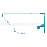
Outline

Summary
| Unique Area Identifier | 531323 |
| Name | Voting District 20585 |
| County | Kern County |
| State | California |
| Area (square miles) | 189.64 |
| Land Area (square miles) | 189.54 |
| Water Area (square miles) | 0.10 |
| % of Land Area | 99.95 |
| % of Water Area | 0.05 |
| Latitude of the Internal Point | 35.15457360 |
| Longtitude of the Internal Point | -117.85885390 |
Maps


Graphs
Select a template below for downloading or customizing gragh for Voting District 20585, Kern County, California


Neighbors
Neighoring Voting District (by Name) Neighboring Voting District on the Map
- Voting District 10370, San Bernardino County, CA
- Voting District 20590, Kern County, CA
- Voting District 20600, Kern County, CA
- Voting District 20605, Kern County, CA
- Voting District 20610, Kern County, CA
- Voting District 20870, Kern County, CA
- Voting District 20875, Kern County, CA
- Voting District 21060, Kern County, CA
- Voting District 21070, Kern County, CA
- Voting District 21135, Kern County, CA
- Voting District 21240, Kern County, CA
- Voting District 21245, Kern County, CA
Top 10 Neighboring County Subdivision (by Population) Neighboring County Subdivision on the Map
- East Kern CCD, Kern County, CA (78,648)
- Barstow CCD, San Bernardino County, CA (41,257)
- Searles Valley CCD, San Bernardino County, CA (2,174)
Top 10 Neighboring Place (by Population) Neighboring Place on the Map
Top 10 Neighboring Unified School District (by Population) Neighboring Unified School District on the Map
- Sierra Sands Unified School District, CA (35,267)
- Barstow Unified School District, CA (33,588)
- Mojave Unified School District, CA (18,880)
Top 10 Neighboring State Legislative District Lower Chamber (by Population) Neighboring State Legislative District Lower Chamber on the Map
Top 10 Neighboring State Legislative District Upper Chamber (by Population) Neighboring State Legislative District Upper Chamber on the Map
Top 10 Neighboring 111th Congressional District (by Population) Neighboring 111th Congressional District on the Map
Top 10 Neighboring Census Tract (by Population) Neighboring Census Tract on the Map
- Census Tract 116, San Bernardino County, CA (7,444)
- Census Tract 55.07, Kern County, CA (7,198)
- Census Tract 65, Kern County, CA (5,152)
- Census Tract 55.08, Kern County, CA (4,198)
- Census Tract 57, Kern County, CA (2,226)
- Census Tract 89.01, San Bernardino County, CA (2,174)