


Voting District 20650, Kern County, California
About
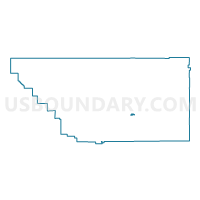
Outline

Summary
| Unique Area Identifier | 531319 |
| Name | Voting District 20650 |
| County | Kern County |
| State | California |
| Area (square miles) | 1.92 |
| Land Area (square miles) | 1.85 |
| Water Area (square miles) | 0.07 |
| % of Land Area | 96.24 |
| % of Water Area | 3.76 |
| Latitude of the Internal Point | 35.13306980 |
| Longtitude of the Internal Point | -118.44962800 |
Maps


Graphs
Select a template below for downloading or customizing gragh for Voting District 20650, Kern County, California


Neighbors
Neighoring Voting District (by Name) Neighboring Voting District on the Map
- Voting District 20625, Kern County, CA
- Voting District 20645, Kern County, CA
- Voting District 20660, Kern County, CA
- Voting District 20730, Kern County, CA
- Voting District 20775, Kern County, CA
- Voting District 20800, Kern County, CA
- Voting District 21095, Kern County, CA
- Voting District 21100, Kern County, CA
- Voting District 21105, Kern County, CA
- Voting District 21110, Kern County, CA
- Voting District 21115, Kern County, CA
Top 10 Neighboring County Subdivision (by Population) Neighboring County Subdivision on the Map
Top 10 Neighboring Place (by Population) Neighboring Place on the Map
Top 10 Neighboring Unified School District (by Population) Neighboring Unified School District on the Map
Top 10 Neighboring State Legislative District Lower Chamber (by Population) Neighboring State Legislative District Lower Chamber on the Map
Top 10 Neighboring State Legislative District Upper Chamber (by Population) Neighboring State Legislative District Upper Chamber on the Map
Top 10 Neighboring 111th Congressional District (by Population) Neighboring 111th Congressional District on the Map
Top 10 Neighboring Census Tract (by Population) Neighboring Census Tract on the Map
- Census Tract 61, Kern County, CA (8,264)
- Census Tract 60.03, Kern County, CA (5,580)
- Census Tract 60.07, Kern County, CA (5,474)
- Census Tract 60.04, Kern County, CA (1,601)