


Voting District 10095, Contra Costa County, California
About
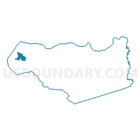
Outline

Summary
| Unique Area Identifier | 529882 |
| Name | Voting District 10095 |
| County | Contra Costa County |
| State | California |
| Area (square miles) | 5.84 |
| Land Area (square miles) | 5.82 |
| Water Area (square miles) | 0.02 |
| % of Land Area | 99.61 |
| % of Water Area | 0.39 |
| Latitude of the Internal Point | 37.98559450 |
| Longtitude of the Internal Point | -122.34245010 |
Maps


Graphs
Select a template below for downloading or customizing gragh for Voting District 10095, Contra Costa County, California


Neighbors
Neighoring Voting District (by Name) Neighboring Voting District on the Map
- Voting District 10015, Contra Costa County, CA
- Voting District 10075, Contra Costa County, CA
- Voting District 10155, Contra Costa County, CA
- Voting District 10230, Contra Costa County, CA
- Voting District 10232, Contra Costa County, CA
- Voting District 10235, Contra Costa County, CA
- Voting District 10245, Contra Costa County, CA
- Voting District 10256, Contra Costa County, CA
- Voting District 10270, Contra Costa County, CA
- Voting District 10290, Contra Costa County, CA
- Voting District 10305, Contra Costa County, CA
- Voting District 10310, Contra Costa County, CA
- Voting District 10315, Contra Costa County, CA
- Voting District 20665, Contra Costa County, CA
- Voting District 20845, Contra Costa County, CA
- Voting District BAY, Contra Costa County, CA
Top 10 Neighboring County Subdivision (by Population) Neighboring County Subdivision on the Map
Top 10 Neighboring Place (by Population) Neighboring Place on the Map
- Richmond city, CA (103,701)
- San Pablo city, CA (29,139)
- Pinole city, CA (18,390)
- El Sobrante CDP, CA (12,669)
- Tara Hills CDP, CA (5,126)
- North Richmond CDP, CA (3,717)
- Rollingwood CDP, CA (2,969)
- Montalvin Manor CDP, CA (2,876)
- Bayview CDP, CA (1,754)
Top 10 Neighboring Unified School District (by Population) Neighboring Unified School District on the Map
Top 10 Neighboring State Legislative District Lower Chamber (by Population) Neighboring State Legislative District Lower Chamber on the Map
Top 10 Neighboring State Legislative District Upper Chamber (by Population) Neighboring State Legislative District Upper Chamber on the Map
Top 10 Neighboring 111th Congressional District (by Population) Neighboring 111th Congressional District on the Map
Top 10 Neighboring Census Tract (by Population) Neighboring Census Tract on the Map
- Census Tract 3922, Contra Costa County, CA (10,605)
- Census Tract 3630, Contra Costa County, CA (7,043)
- Census Tract 3660.02, Contra Costa County, CA (6,093)
- Census Tract 3640.02, Contra Costa County, CA (5,518)
- Census Tract 3650.02, Contra Costa County, CA (5,462)
- Census Tract 3672, Contra Costa County, CA (5,171)
- Census Tract 3671, Contra Costa County, CA (5,099)
- Census Tract 3650.03, Contra Costa County, CA (4,924)
- Census Tract 3660.01, Contra Costa County, CA (4,307)
- Census Tract 3690.02, Contra Costa County, CA (2,548)