


Voting District 10410, Contra Costa County, California
About
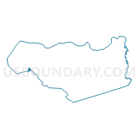
Outline

Summary
| Unique Area Identifier | 529745 |
| Name | Voting District 10410 |
| County | Contra Costa County |
| State | California |
| Area (square miles) | 0.90 |
| Land Area (square miles) | 0.89 |
| Water Area (square miles) | 0.01 |
| % of Land Area | 98.96 |
| % of Water Area | 1.04 |
| Latitude of the Internal Point | 37.90518300 |
| Longtitude of the Internal Point | -122.28433080 |
Maps


Graphs
Select a template below for downloading or customizing gragh for Voting District 10410, Contra Costa County, California


Neighbors
Neighoring Voting District (by Name) Neighboring Voting District on the Map
- Voting District 10125, Contra Costa County, CA
- Voting District 10325, Contra Costa County, CA
- Voting District 10415, Contra Costa County, CA
- Voting District 10420, Contra Costa County, CA
- Voting District 10440, Contra Costa County, CA
- Voting District 10445, Contra Costa County, CA
- Voting District 10456, Contra Costa County, CA
- Voting District 51595, Alameda County, CA
- Voting District 51655, Alameda County, CA
- Voting District 51660, Alameda County, CA
Top 10 Neighboring County Subdivision (by Population) Neighboring County Subdivision on the Map
Top 10 Neighboring Place (by Population) Neighboring Place on the Map
- Berkeley city, CA (112,580)
- Richmond city, CA (103,701)
- El Cerrito city, CA (23,549)
- Albany city, CA (18,539)
- Kensington CDP, CA (5,077)
Top 10 Neighboring Unified School District (by Population) Neighboring Unified School District on the Map
- West Contra Costa Unified School District, CA (235,847)
- Berkeley Unified School District, CA (112,517)
- Albany City Unified School District, CA (18,549)
Top 10 Neighboring State Legislative District Lower Chamber (by Population) Neighboring State Legislative District Lower Chamber on the Map
Top 10 Neighboring State Legislative District Upper Chamber (by Population) Neighboring State Legislative District Upper Chamber on the Map
Top 10 Neighboring 111th Congressional District (by Population) Neighboring 111th Congressional District on the Map
- Congressional District 10, CA (714,750)
- Congressional District 7, CA (655,708)
- Congressional District 9, CA (648,766)
Top 10 Neighboring Census Tract (by Population) Neighboring Census Tract on the Map
- Census Tract 3610, Contra Costa County, CA (4,475)
- Census Tract 4213, Alameda County, CA (3,844)
- Census Tract 4212, Alameda County, CA (3,563)
- Census Tract 3851, Contra Costa County, CA (2,765)
- Census Tract 3910, Contra Costa County, CA (2,556)
- Census Tract 3920, Contra Costa County, CA (2,451)
- Census Tract 4201, Alameda County, CA (2,355)
- Census Tract 3901, Contra Costa County, CA (2,229)
- Census Tract 4211, Alameda County, CA (1,992)
- Census Tract 3902, Contra Costa County, CA (1,719)