


Dixon Voting District, Monroe County, Arkansas
About
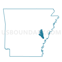
Outline

Summary
| Unique Area Identifier | 527403 |
| Name | Dixon Voting District |
| County | Monroe County |
| State | Arkansas |
| Area (square miles) | 25.17 |
| Land Area (square miles) | 24.99 |
| Water Area (square miles) | 0.18 |
| % of Land Area | 99.28 |
| % of Water Area | 0.72 |
| Latitude of the Internal Point | 34.85541980 |
| Longtitude of the Internal Point | -91.14054850 |
Maps


Graphs
Select a template below for downloading or customizing gragh for Dixon Voting District, Monroe County, Arkansas


Neighbors
Neighoring Voting District (by Name) Neighboring Voting District on the Map
- Brinkley TWP Voting District, Monroe County, AR
- Brinkley Ward 2, Monroe County, AR
- Cypress Ridge Voting District, Monroe County, AR
- Fleener Voting District, Lee County, AR
- Hampton Voting District, Lee County, AR
- Richland Voting District, Monroe County, AR
- WHEATLEY COUNTRY PCT 34, St. Francis County, AR
- WHEATLEY PCT 33, St. Francis County, AR
Top 10 Neighboring County Subdivision (by Population) Neighboring County Subdivision on the Map
- Brinkley township, Monroe County, AR (3,509)
- Hampton township, Lee County, AR (690)
- Wheatley township, St. Francis County, AR (401)
- Cypress Ridge township, Monroe County, AR (339)
- Fleener township, Lee County, AR (309)
- Dixon township, Monroe County, AR (225)
- Richland township, Monroe County, AR (160)
Top 10 Neighboring Place (by Population) Neighboring Place on the Map
Top 10 Neighboring Unified School District (by Population) Neighboring Unified School District on the Map
- Lee County School District, AR (10,424)
- Brinkley School District, AR (4,479)
- Palestine-Wheatley School District, AR (2,340)
Top 10 Neighboring State Legislative District Lower Chamber (by Population) Neighboring State Legislative District Lower Chamber on the Map
Top 10 Neighboring State Legislative District Upper Chamber (by Population) Neighboring State Legislative District Upper Chamber on the Map
Top 10 Neighboring 111th Congressional District (by Population) Neighboring 111th Congressional District on the Map
Top 10 Neighboring Census Tract (by Population) Neighboring Census Tract on the Map
- Census Tract 9501, Monroe County, AR (3,787)
- Census Tract 9603, St. Francis County, AR (2,700)
- Census Tract 9503, Monroe County, AR (2,222)
- Census Tract 4702, Lee County, AR (1,713)