


Morrilton Ward 3, Conway County, Arkansas
About
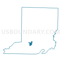
Outline

Summary
| Unique Area Identifier | 526239 |
| Name | Morrilton Ward 3 |
| County | Conway County |
| State | Arkansas |
| Area (square miles) | 2.48 |
| Land Area (square miles) | 2.43 |
| Water Area (square miles) | 0.05 |
| % of Land Area | 97.89 |
| % of Water Area | 2.11 |
| Latitude of the Internal Point | 35.15906110 |
| Longtitude of the Internal Point | -92.75940420 |
Maps


Graphs
Select a template below for downloading or customizing gragh for Morrilton Ward 3, Conway County, Arkansas


Neighbors
Neighoring Voting District (by Name) Neighboring Voting District on the Map
- Morrilton Ward 2, Conway County, AR
- Morrilton Ward 4, Conway County, AR
- Welbourne West Voting District, Conway County, AR