


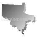
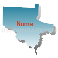
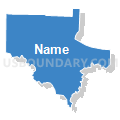
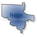
Gregory Voting District, Conway County, Arkansas
About
Outline

Summary
| Unique Area Identifier | 526230 |
| Name | Gregory Voting District |
| County | Conway County |
| State | Arkansas |
| Area (square miles) | 22.79 |
| Land Area (square miles) | 22.05 |
| Water Area (square miles) | 0.74 |
| % of Land Area | 96.75 |
| % of Water Area | 3.25 |
| Latitude of the Internal Point | 35.28232590 |
| Longtitude of the Internal Point | -92.80447860 |
Maps


Graphs
Select a template below for downloading or customizing gragh for Gregory Voting District, Conway County, Arkansas


Neighbors
Neighoring Voting District (by Name) Neighboring Voting District on the Map
- Burnett Voting District, Pope County, AR
- Old Hickory Voting District, Conway County, AR
- St. Vincent Voting District, Conway County, AR
- Washington West Voting District, Conway County, AR
- Welbourne West Voting District, Conway County, AR
Top 10 Neighboring County Subdivision (by Population) Neighboring County Subdivision on the Map
- Washington township, Conway County, AR (1,852)
- St. Vincent township, Conway County, AR (640)
- Burnett township, Pope County, AR (506)
- Gregory township, Conway County, AR (376)
- Old Hickory township, Conway County, AR (203)
Top 10 Neighboring Unified School District (by Population) Neighboring Unified School District on the Map
- South Conway County School District, AR (15,782)
- Atkins Public Schools, AR (6,607)
- Wonderview School District, AR (2,858)