


Voting District 7, Pima County, Arizona
About
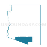
Outline

Summary
| Unique Area Identifier | 525314 |
| Name | Voting District 7 |
| County | Pima County |
| State | Arizona |
| Area (square miles) | 277.55 |
| Land Area (square miles) | 277.55 |
| Water Area (square miles) | 0.01 |
| % of Land Area | 100.00 |
| % of Water Area | 0.00 |
| Latitude of the Internal Point | 31.87542410 |
| Longtitude of the Internal Point | -111.42743190 |
Maps


Graphs
Select a template below for downloading or customizing gragh for Voting District 7, Pima County, Arizona


Neighbors
Neighoring Voting District (by Name) Neighboring Voting District on the Map
- Voting District 204, Pima County, AZ
- Voting District 208, Pima County, AZ
- Voting District 257, Pima County, AZ
- Voting District 3, Pima County, AZ
- Voting District 309, Pima County, AZ
- Voting District 378, Pima County, AZ
- Voting District 8, Pima County, AZ
Top 10 Neighboring County Subdivision (by Population) Neighboring County Subdivision on the Map
- Arivaca CCD, Pima County, AZ (81,534)
- Marana CCD, Pima County, AZ (34,429)
- Tohono O'odnam Nation CCD, Pima County, AZ (7,174)
Top 10 Neighboring Place (by Population) Neighboring Place on the Map
Top 10 Neighboring Elementary School District (by Population) Neighboring Elementary School District on the Map
Top 10 Neighboring Unified School District (by Population) Neighboring Unified School District on the Map
Top 10 Neighboring State Legislative District Lower Chamber (by Population) Neighboring State Legislative District Lower Chamber on the Map
- State House District 30, AZ (231,236)
- State House District 25, AZ (208,220)
- State House District 27, AZ (199,340)
Top 10 Neighboring State Legislative District Upper Chamber (by Population) Neighboring State Legislative District Upper Chamber on the Map
- State Senate District 30, AZ (231,236)
- State Senate District 25, AZ (208,220)
- State Senate District 27, AZ (199,340)
Top 10 Neighboring 111th Congressional District (by Population) Neighboring 111th Congressional District on the Map
Top 10 Neighboring Census Tract (by Population) Neighboring Census Tract on the Map
- Census Tract 9408, Pima County, AZ (4,462)
- Census Tract 44.24, Pima County, AZ (4,270)
- Census Tract 43.16, Pima County, AZ (3,599)
Top 10 Neighboring 5-Digit ZIP Code Tabulation Area (by Population) Neighboring 5-Digit ZIP Code Tabulation Area on the Map
- 85629, AZ (23,568)
- 85735, AZ (11,250)
- 85634, AZ (6,490)
- 85736, AZ (4,975)
- 85645, AZ (2,231)
- 85633, AZ (54)