


PONDEROSA Voting District, Maricopa County, Arizona
About
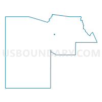
Outline

Summary
| Unique Area Identifier | 524654 |
| Name | PONDEROSA Voting District |
| County | Maricopa County |
| State | Arizona |
| Area (square miles) | 0.95 |
| Land Area (square miles) | 0.95 |
| Water Area (square miles) | 0.00 |
| % of Land Area | 100.00 |
| % of Water Area | 0.00 |
| Latitude of the Internal Point | 33.63262580 |
| Longtitude of the Internal Point | -112.10787950 |
Maps


Graphs
Select a template below for downloading or customizing gragh for PONDEROSA Voting District, Maricopa County, Arizona


Neighbors
Neighoring Voting District (by Name) Neighboring Voting District on the Map
- CHARLESTON Voting District, Maricopa County, AZ
- GROVERS Voting District, Maricopa County, AZ
- KINGS Voting District, Maricopa County, AZ
- MAUNA LOA Voting District, Maricopa County, AZ
- PORT ROYALE Voting District, Maricopa County, AZ
- SHADY GLEN Voting District, Maricopa County, AZ
- TURF PARADISE Voting District, Maricopa County, AZ
- VILLAGE MEADOWS Voting District, Maricopa County, AZ
Top 10 Neighboring County Subdivision (by Population) Neighboring County Subdivision on the Map
Top 10 Neighboring Place (by Population) Neighboring Place on the Map
Top 10 Neighboring Elementary School District (by Population) Neighboring Elementary School District on the Map
Top 10 Neighboring Secondary School District (by Population) Neighboring Secondary School District on the Map
Top 10 Neighboring Unified School District (by Population) Neighboring Unified School District on the Map
Top 10 Neighboring State Legislative District Lower Chamber (by Population) Neighboring State Legislative District Lower Chamber on the Map
Top 10 Neighboring State Legislative District Upper Chamber (by Population) Neighboring State Legislative District Upper Chamber on the Map
Top 10 Neighboring 111th Congressional District (by Population) Neighboring 111th Congressional District on the Map
Top 10 Neighboring Census Tract (by Population) Neighboring Census Tract on the Map
- Census Tract 1041, Maricopa County, AZ (6,567)
- Census Tract 1036.05, Maricopa County, AZ (5,967)
- Census Tract 1036.09, Maricopa County, AZ (5,280)
- Census Tract 6188, Maricopa County, AZ (5,074)
- Census Tract 6186, Maricopa County, AZ (4,241)
- Census Tract 1042.07, Maricopa County, AZ (4,240)
- Census Tract 1036.04, Maricopa County, AZ (4,098)
- Census Tract 6185, Maricopa County, AZ (3,647)
- Census Tract 1036.08, Maricopa County, AZ (3,587)