


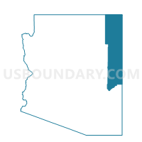
Steamboat Voting District, Apache County, Arizona
About
Outline

Summary
| Unique Area Identifier | 523636 |
| Name | Steamboat Voting District |
| County | Apache County |
| State | Arizona |
| Area (square miles) | 320.30 |
| Land Area (square miles) | 319.82 |
| Water Area (square miles) | 0.48 |
| % of Land Area | 99.85 |
| % of Water Area | 0.15 |
| Latitude of the Internal Point | 35.81439640 |
| Longtitude of the Internal Point | -109.87392670 |
Maps


Graphs
Select a template below for downloading or customizing gragh for Steamboat Voting District, Apache County, Arizona


Neighbors
Neighoring Voting District (by Name) Neighboring Voting District on the Map
- Cornfields Voting District, Apache County, AZ
- Cottonwood Voting District, Apache County, AZ
- Ganado North Voting District, Apache County, AZ
- Ganado South Voting District, Apache County, AZ
- Greasewood Voting District, Navajo County, AZ
- Jeddito 1 Voting District, Navajo County, AZ
- Low Mountain 1 Voting District, Navajo County, AZ
- Whitecone 2 Voting District, Navajo County, AZ
Top 10 Neighboring County Subdivision (by Population) Neighboring County Subdivision on the Map
- Fort Defiance CCD, Apache County, AZ (23,325)
- Chinle CCD, Apache County, AZ (20,896)
- Pinon CCD, Navajo County, AZ (7,265)
- Hopi CCD, Navajo County, AZ (6,950)
- Indian Wells CCD, Navajo County, AZ (6,926)
Top 10 Neighboring Place (by Population) Neighboring Place on the Map
Top 10 Neighboring Unified School District (by Population) Neighboring Unified School District on the Map
- Chinle Unified District, AZ (20,202)
- Cedar Unified District, AZ (7,264)
- Ganado Unified District, AZ (7,181)
- Pinon Unified District, AZ (7,087)
Top 10 Neighboring State Legislative District Lower Chamber (by Population) Neighboring State Legislative District Lower Chamber on the Map
Top 10 Neighboring State Legislative District Upper Chamber (by Population) Neighboring State Legislative District Upper Chamber on the Map
Top 10 Neighboring 111th Congressional District (by Population) Neighboring 111th Congressional District on the Map
Top 10 Neighboring Census Tract (by Population) Neighboring Census Tract on the Map
- Census Tract 9443, Apache County, AZ (6,958)
- Census Tract 9449.02, Apache County, AZ (4,853)
- Census Tract 9400.13, Navajo County, AZ (4,191)
- Census Tract 9400.10, Navajo County, AZ (3,088)
- Census Tract 9400.14, Navajo County, AZ (2,750)