


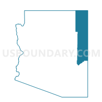
Alpine Voting District, Apache County, Arizona
About
Outline

Summary
| Unique Area Identifier | 523615 |
| Name | Alpine Voting District |
| County | Apache County |
| State | Arizona |
| Area (square miles) | 211.68 |
| Land Area (square miles) | 211.11 |
| Water Area (square miles) | 0.57 |
| % of Land Area | 99.73 |
| % of Water Area | 0.27 |
| Latitude of the Internal Point | 33.81644810 |
| Longtitude of the Internal Point | -109.28397520 |
Maps


Graphs
Select a template below for downloading or customizing gragh for Alpine Voting District, Apache County, Arizona


Neighbors
Neighoring Voting District (by Name) Neighboring Voting District on the Map
- Blue Voting District, Greenlee County, AZ
- Catron County Precinct 6, Catron County, NM
- Eagar Voting District, Apache County, AZ
- Eagle Voting District, Greenlee County, AZ
- Greer Voting District, Apache County, AZ
- McNary Voting District, Apache County, AZ
- Nutrioso Voting District, Apache County, AZ
- Peridot 16 Voting District, Graham County, AZ
Top 10 Neighboring County Subdivision (by Population) Neighboring County Subdivision on the Map
- Eagar-Springerville CCD, Apache County, AZ (8,802)
- Clifton CCD, Greenlee County, AZ (5,849)
- San Carlos CCD, Graham County, AZ (4,780)
- Reserve CCD, Catron County, NM (1,802)
- Fort Apache CCD, Apache County, AZ (555)
Top 10 Neighboring Place (by Population) Neighboring Place on the Map
Top 10 Neighboring Elementary School District (by Population) Neighboring Elementary School District on the Map
- Solomon Elementary District, AZ (2,883)
- Alpine Elementary District, AZ (463)
- Blue Elementary District, AZ (37)
- Eagle Elementary District, AZ (37)
Top 10 Neighboring Unified School District (by Population) Neighboring Unified School District on the Map
Top 10 Neighboring State Legislative District Lower Chamber (by Population) Neighboring State Legislative District Lower Chamber on the Map
Top 10 Neighboring State Legislative District Upper Chamber (by Population) Neighboring State Legislative District Upper Chamber on the Map
Top 10 Neighboring 111th Congressional District (by Population) Neighboring 111th Congressional District on the Map
Top 10 Neighboring Census Tract (by Population) Neighboring Census Tract on the Map
- Census Tract 9405, Graham County, AZ (4,780)
- Census Tract 9705.02, Apache County, AZ (4,276)
- Census Tract 9764, Catron County, NM (3,725)
- Census Tract 9601, Greenlee County, AZ (2,886)
Top 10 Neighboring 5-Digit ZIP Code Tabulation Area (by Population) Neighboring 5-Digit ZIP Code Tabulation Area on the Map
- 85941, AZ (9,941)
- 85533, AZ (2,943)
- 85920, AZ (464)
- 85932, AZ (364)
- 87824, NM (194)
- 85927, AZ (176)
- 85922, AZ (41)