


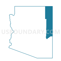
Greer Voting District, Apache County, Arizona
About
Outline

Summary
| Unique Area Identifier | 523612 |
| Name | Greer Voting District |
| County | Apache County |
| State | Arizona |
| Area (square miles) | 78.70 |
| Land Area (square miles) | 77.37 |
| Water Area (square miles) | 1.33 |
| % of Land Area | 98.31 |
| % of Water Area | 1.69 |
| Latitude of the Internal Point | 33.99083730 |
| Longtitude of the Internal Point | -109.47875200 |
Maps


Graphs
Select a template below for downloading or customizing gragh for Greer Voting District, Apache County, Arizona


Neighbors
Neighoring Voting District (by Name) Neighboring Voting District on the Map
- Alpine Voting District, Apache County, AZ
- Eagar Voting District, Apache County, AZ
- McNary Voting District, Apache County, AZ
- Vernon Voting District, Apache County, AZ