


Wheatfields Voting District, Apache County, Arizona
About
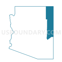
Outline

Summary
| Unique Area Identifier | 523595 |
| Name | Wheatfields Voting District |
| County | Apache County |
| State | Arizona |
| Area (square miles) | 321.91 |
| Land Area (square miles) | 320.78 |
| Water Area (square miles) | 1.14 |
| % of Land Area | 99.65 |
| % of Water Area | 0.35 |
| Latitude of the Internal Point | 36.22831270 |
| Longtitude of the Internal Point | -109.22031380 |
Maps


Graphs
Select a template below for downloading or customizing gragh for Wheatfields Voting District, Apache County, Arizona


Neighbors
Neighoring Voting District (by Name) Neighboring Voting District on the Map
- Canyon de Chelly Voting District, Apache County, AZ
- Lukachukai Voting District, Apache County, AZ
- Many Farms Voting District, Apache County, AZ
- Red Valley Voting District, Apache County, AZ
- San Juan County Precinct 8, San Juan County, NM
- San Juan County Precinct 9, San Juan County, NM
- Sawmill Voting District, Apache County, AZ
Top 10 Neighboring County Subdivision (by Population) Neighboring County Subdivision on the Map
- Fort Defiance CCD, Apache County, AZ (23,325)
- Chinle CCD, Apache County, AZ (20,896)
- Shiprock-Sanostee CCD, San Juan County, NM (16,634)
- Sweetwater CCD, Apache County, AZ (5,628)
- Naschitti CCD, San Juan County, NM (1,944)
Top 10 Neighboring Place (by Population) Neighboring Place on the Map
Top 10 Neighboring Unified School District (by Population) Neighboring Unified School District on the Map
- Central Consolidated Schools, NM (33,082)
- Chinle Unified District, AZ (20,202)
- Red Mesa Unified District, AZ (8,605)
Top 10 Neighboring State Legislative District Lower Chamber (by Population) Neighboring State Legislative District Lower Chamber on the Map
- State House District 2, AZ (177,904)
- State House District 4, NM (28,107)
- State House District 9, NM (26,110)
Top 10 Neighboring State Legislative District Upper Chamber (by Population) Neighboring State Legislative District Upper Chamber on the Map
Top 10 Neighboring 111th Congressional District (by Population) Neighboring 111th Congressional District on the Map
Top 10 Neighboring Census Tract (by Population) Neighboring Census Tract on the Map
- Census Tract 9443, Apache County, AZ (6,958)
- Census Tract 9440, Apache County, AZ (6,043)
- Census Tract 9441, Apache County, AZ (5,870)
- Census Tract 9427, Apache County, AZ (5,628)
- Census Tract 9429, San Juan County, NM (4,929)
- Census Tract 9442.02, Apache County, AZ (4,053)
- Census Tract 9431, San Juan County, NM (1,943)
Top 10 Neighboring 5-Digit ZIP Code Tabulation Area (by Population) Neighboring 5-Digit ZIP Code Tabulation Area on the Map
- 87420, NM (11,967)
- 86503, AZ (10,714)
- 86504, AZ (6,589)
- 86507, AZ (2,340)
- 86538, AZ (2,338)
- 86556, AZ (2,090)
- 87461, NM (1,315)
- 86544, AZ (1,267)