


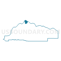
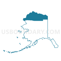
Browerville Precinct, North Slope Borough, Alaska
About
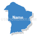
Outline

Summary
| Unique Area Identifier | 523486 |
| Name | Browerville Precinct |
| County | North Slope Borough |
| State | Alaska |
| Area (square miles) | 778.59 |
| Land Area (square miles) | 447.22 |
| Water Area (square miles) | 331.37 |
| % of Land Area | 57.44 |
| % of Water Area | 42.56 |
| Latitude of the Internal Point | 71.17225830 |
| Longtitude of the Internal Point | -156.34990430 |
Maps

Graphs
Select a template below for downloading or customizing gragh for Browerville Precinct, North Slope Borough, Alaska


Neighbors
Neighoring Voting District (by Name) Neighboring Voting District on the Map
- Barrow Precinct, North Slope Borough, AK
- Nuiqsut Precinct, North Slope Borough, AK
- Wainwright Precinct, North Slope Borough, AK