Diomede Precinct, Nome Census Area, Alaska
About
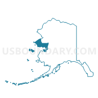
Outline

Summary
| Unique Area Identifier | 523482 |
| Name | Diomede Precinct |
| County | Nome Census Area |
| State | Alaska |
| Area (square miles) | 83.85 |
| Land Area (square miles) | 2.96 |
| Water Area (square miles) | 80.89 |
| % of Land Area | 3.53 |
| % of Water Area | 96.47 |
| Latitude of the Internal Point | 65.75866850 |
| Longtitude of the Internal Point | -168.92502150 |
Maps


Graphs
Select a template below for downloading or customizing gragh for Diomede Precinct, Nome Census Area, Alaska