


Haines No. 1 Precinct, Haines Borough, Alaska
About
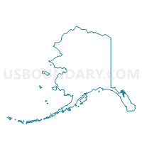
Outline

Summary
| Unique Area Identifier | 523355 |
| Name | Haines No. 1 Precinct |
| County | Haines Borough |
| State | Alaska |
| Area (square miles) | 2,083.11 |
| Land Area (square miles) | 1,710.59 |
| Water Area (square miles) | 372.52 |
| % of Land Area | 82.12 |
| % of Water Area | 17.88 |
| Latitude of the Internal Point | 58.70294770 |
| Longtitude of the Internal Point | -135.24890680 |
Maps


Graphs
Select a template below for downloading or customizing gragh for Haines No. 1 Precinct, Haines Borough, Alaska


Neighbors
Neighoring Voting District (by Name) Neighboring Voting District on the Map
- Angoon Precinct (Part; Also See Parts In Four Other Boroughs and Census Areas), Hoonah-Angoon Census Area, AK
- Gustavus Precinct, Hoonah-Angoon Census Area, AK
- Haines Highway Precinct, Haines Borough, AK
- Hoonah Precinct, Hoonah-Angoon Census Area, AK
- Lynn Canal Precinct, Juneau City and Borough, AK
- Skagway Precinct, Skagway Municipality, AK
Top 10 Neighboring County Subdivision (by Population) Neighboring County Subdivision on the Map
- Juneau census subarea, Juneau City and Borough, AK (31,275)
- Haines census subarea, Haines Borough, AK (2,508)
- Hoonah-Angoon census subarea, Hoonah-Angoon Census Area, AK (2,055)
- Skagway census subarea, Skagway Municipality, AK (968)
Top 10 Neighboring Place (by Population) Neighboring Place on the Map
- Juneau city and borough, AK (31,275)
- Haines CDP, AK (1,713)
- Mud Bay CDP, AK (212)
- Lutak CDP, AK (49)
- Excursion Inlet CDP, AK (12)
Top 10 Neighboring Unified School District (by Population) Neighboring Unified School District on the Map
- Juneau Borough School District, AK (31,275)
- Haines Borough School District, AK (2,508)
- Chatham School District, AK (1,304)
- Skagway School District, AK (968)
Top 10 Neighboring State Legislative District Lower Chamber (by Population) Neighboring State Legislative District Lower Chamber on the Map
- State House District 4, Juneau-Mendenhall Valley, AK (15,842)
- State House District 5, Cordova-Southeast Islands, AK (13,846)
Top 10 Neighboring State Legislative District Upper Chamber (by Population) Neighboring State Legislative District Upper Chamber on the Map
Top 10 Neighboring 111th Congressional District (by Population) Neighboring 111th Congressional District on the Map
Top 10 Neighboring Census Tract (by Population) Neighboring Census Tract on the Map
- Census Tract 1, Juneau City and Borough, AK (4,933)
- Census Tract 5, Juneau City and Borough, AK (3,498)
- Census Tract 1, Haines Borough, AK (2,508)
- Census Tract 3, Hoonah-Angoon Census Area, AK (2,055)
- Census Tract 1, Skagway Municipality, AK (968)