


Kasigluk Precinct, Bethel Census Area, Alaska
About
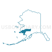
Outline

Summary
| Unique Area Identifier | 523289 |
| Name | Kasigluk Precinct |
| County | Bethel Census Area |
| State | Alaska |
| Area (square miles) | 3,505.77 |
| Land Area (square miles) | 3,212.04 |
| Water Area (square miles) | 293.73 |
| % of Land Area | 91.62 |
| % of Water Area | 8.38 |
| Latitude of the Internal Point | 60.73951890 |
| Longtitude of the Internal Point | -163.13350990 |
Maps


Graphs
Select a template below for downloading or customizing gragh for Kasigluk Precinct, Bethel Census Area, Alaska


Neighbors
Neighoring Voting District (by Name) Neighboring Voting District on the Map
- Akiachak Precinct, Bethel Census Area, AK
- Atmautluak Precinct, Bethel Census Area, AK
- Chefornak Precinct, Bethel Census Area, AK
- Chevak Precinct, Wade Hampton Census Area, AK
- Marshall Precinct, Wade Hampton Census Area, AK
- Napakiak Precinct, Bethel Census Area, AK
- Napaskiak Precinct, Bethel Census Area, AK
- Newtok Precinct, Bethel Census Area, AK
- Nunapitchuk Precinct, Bethel Census Area, AK
- Russian Mission Precinct, Wade Hampton Census Area, AK
- Tuntutuliak Precinct, Bethel Census Area, AK
- Upper Kalskag Precinct, Bethel Census Area, AK
Top 10 Neighboring County Subdivision (by Population) Neighboring County Subdivision on the Map
- Lower Kuskokwim census subarea, Bethel Census Area, AK (15,563)
- Wade Hampton census subarea, Wade Hampton Census Area, AK (7,459)
Top 10 Neighboring Place (by Population) Neighboring Place on the Map
Top 10 Neighboring Unified School District (by Population) Neighboring Unified School District on the Map
Top 10 Neighboring State Legislative District Lower Chamber (by Population) Neighboring State Legislative District Lower Chamber on the Map
- State House District 38, Bethel, AK (16,055)
- State House District 39, Bering Straits, AK (15,642)
- State House District 6, Interior Villages, AK (14,235)
Top 10 Neighboring State Legislative District Upper Chamber (by Population) Neighboring State Legislative District Upper Chamber on the Map
- State Senate District T, AK (33,158)
- State Senate District S, AK (31,254)
- State Senate District C, AK (28,081)