


Kwethluk Precinct, Bethel Census Area, Alaska
About
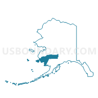
Outline

Summary
| Unique Area Identifier | 523279 |
| Name | Kwethluk Precinct |
| County | Bethel Census Area |
| State | Alaska |
| Area (square miles) | 2,159.78 |
| Land Area (square miles) | 2,150.38 |
| Water Area (square miles) | 9.40 |
| % of Land Area | 99.56 |
| % of Water Area | 0.44 |
| Latitude of the Internal Point | 60.43956760 |
| Longtitude of the Internal Point | -160.43829740 |
Maps


Graphs
Select a template below for downloading or customizing gragh for Kwethluk Precinct, Bethel Census Area, Alaska


Neighbors
Neighoring Voting District (by Name) Neighboring Voting District on the Map
- Akiachak Precinct, Bethel Census Area, AK
- Akiak Precinct, Bethel Census Area, AK
- Aleknagik Precinct, Dillingham Census Area, AK
- Eek Precinct, Bethel Census Area, AK
- Napaskiak Precinct, Bethel Census Area, AK
Top 10 Neighboring County Subdivision (by Population) Neighboring County Subdivision on the Map
- Lower Kuskokwim census subarea, Bethel Census Area, AK (15,563)
- Dillingham census subarea, Dillingham Census Area, AK (4,847)
- Aniak census subarea, Bethel Census Area, AK (1,450)
Top 10 Neighboring Place (by Population) Neighboring Place on the Map
Top 10 Neighboring Unified School District (by Population) Neighboring Unified School District on the Map
Top 10 Neighboring State Legislative District Lower Chamber (by Population) Neighboring State Legislative District Lower Chamber on the Map
- State House District 38, Bethel, AK (16,055)
- State House District 37, Bristol Bay-Aleutians, AK (15,199)
Top 10 Neighboring State Legislative District Upper Chamber (by Population) Neighboring State Legislative District Upper Chamber on the Map
Top 10 Neighboring 111th Congressional District (by Population) Neighboring 111th Congressional District on the Map
Top 10 Neighboring Census Tract (by Population) Neighboring Census Tract on the Map
- Census Tract 1, Bethel Census Area, AK (9,483)
- Census Tract 1, Dillingham Census Area, AK (2,466)
- Census Tract 3, Bethel Census Area, AK (1,450)