


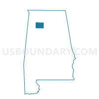
Moreland Cemetery, Winston County, Alabama
About
Outline

Summary
| Unique Area Identifier | 523129 |
| Name | Moreland Cemetery |
| County | Winston County |
| State | Alabama |
| Area (square miles) | 68.36 |
| Land Area (square miles) | 67.90 |
| Water Area (square miles) | 0.47 |
| % of Land Area | 99.32 |
| % of Water Area | 0.68 |
| Latitude of the Internal Point | 34.24880970 |
| Longtitude of the Internal Point | -87.27694890 |
Maps

Graphs
Select a template below for downloading or customizing gragh for Moreland Cemetery, Winston County, Alabama


Neighbors
Neighoring Voting District (by Name) Neighboring Voting District on the Map
- Addison Community Center, Winston County, AL
- Ashridge Fire Dept, Winston County, AL
- Double Springs Community Center, Winston County, AL
- Houston Fire Dept, Winston County, AL
- Lindsay Hall Church, Lawrence County, AL
- Mt. Hope Fire Station, Lawrence County, AL
- Piney Grove Church, Lawrence County, AL
- Pleasant Grove Church A, Lawrence County, AL
- Pleasant Grove Church C, Lawrence County, AL
Top 10 Neighboring County Subdivision (by Population) Neighboring County Subdivision on the Map
- Addison CCD, Winston County, AL (7,884)
- Moulton CCD, Lawrence County, AL (7,783)
- Double Springs CCD, Winston County, AL (5,415)
- Speake-Oakville CCD, Lawrence County, AL (2,124)
- Mount Hope CCD, Lawrence County, AL (1,942)
Top 10 Neighboring Unified School District (by Population) Neighboring Unified School District on the Map
Top 10 Neighboring State Legislative District Lower Chamber (by Population) Neighboring State Legislative District Lower Chamber on the Map
Top 10 Neighboring State Legislative District Upper Chamber (by Population) Neighboring State Legislative District Upper Chamber on the Map
Top 10 Neighboring 111th Congressional District (by Population) Neighboring 111th Congressional District on the Map
Top 10 Neighboring Census Tract (by Population) Neighboring Census Tract on the Map
- Census Tract 9656, Winston County, AL (5,415)
- Census Tract 9798, Lawrence County, AL (3,269)
- Census Tract 9655.02, Winston County, AL (2,871)
- Census Tract 9655.01, Winston County, AL (2,393)
- Census Tract 9797, Lawrence County, AL (2,124)
- Census Tract 9799, Lawrence County, AL (1,942)
Top 10 Neighboring 5-Digit ZIP Code Tabulation Area (by Population) Neighboring 5-Digit ZIP Code Tabulation Area on the Map
- 35650, AL (13,971)
- 35565, AL (13,485)
- 35619, AL (5,135)
- 35553, AL (4,680)
- 35540, AL (2,415)
- 35572, AL (1,131)