


Canton Bend, Wilcox County, Alabama
About
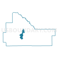
Outline

Summary
| Unique Area Identifier | 523102 |
| Name | Canton Bend |
| County | Wilcox County |
| State | Alabama |
| Area (square miles) | 16.91 |
| Land Area (square miles) | 16.61 |
| Water Area (square miles) | 0.30 |
| % of Land Area | 98.21 |
| % of Water Area | 1.79 |
| Latitude of the Internal Point | 31.98113470 |
| Longtitude of the Internal Point | -87.37243020 |
Maps


Graphs
Select a template below for downloading or customizing gragh for Canton Bend, Wilcox County, Alabama


Neighbors
Neighoring Voting District (by Name) Neighboring Voting District on the Map
- Coy 3003 3010, Wilcox County, AL
- Magnolia, Wilcox County, AL
- Millers Ferry, Wilcox County, AL
- Whiskey Run, Wilcox County, AL
- Yellow Bluff, Wilcox County, AL
Top 10 Neighboring County Subdivision (by Population) Neighboring County Subdivision on the Map
- Camden CCD, Wilcox County, AL (4,533)
- Pine Hill CCD, Wilcox County, AL (3,789)
- Coy-Fatama CCD, Wilcox County, AL (1,059)
Top 10 Neighboring Unified School District (by Population) Neighboring Unified School District on the Map
Top 10 Neighboring State Legislative District Lower Chamber (by Population) Neighboring State Legislative District Lower Chamber on the Map
Top 10 Neighboring State Legislative District Upper Chamber (by Population) Neighboring State Legislative District Upper Chamber on the Map
Top 10 Neighboring 111th Congressional District (by Population) Neighboring 111th Congressional District on the Map
Top 10 Neighboring Census Tract (by Population) Neighboring Census Tract on the Map
- Census Tract 348, Wilcox County, AL (4,533)
- Census Tract 351, Wilcox County, AL (3,789)
- Census Tract 352, Wilcox County, AL (2,040)