


Memorial Park, Walker County, Alabama
About
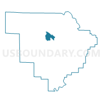
Outline

Summary
| Unique Area Identifier | 523069 |
| Name | Memorial Park |
| County | Walker County |
| State | Alabama |
| Area (square miles) | 7.68 |
| Land Area (square miles) | 7.66 |
| Water Area (square miles) | 0.02 |
| % of Land Area | 99.76 |
| % of Water Area | 0.24 |
| Latitude of the Internal Point | 33.84861520 |
| Longtitude of the Internal Point | -87.30929530 |
Maps


Graphs
Select a template below for downloading or customizing gragh for Memorial Park, Walker County, Alabama


Neighbors
Neighoring Voting District (by Name) Neighboring Voting District on the Map
- Farmstead School Voting District, Walker County, AL
- Jasper Mall Voting District, Walker County, AL
- Macedonia Church Of Christ, Walker County, AL
- Manchester Community, Walker County, AL
- Meadow Smith Library/Frisco Voting District, Walker County, AL
- Redmill Community Center Voting District, Walker County, AL
- Westside Baptist Church, Walker County, AL
Top 10 Neighboring County Subdivision (by Population) Neighboring County Subdivision on the Map
Top 10 Neighboring Place (by Population) Neighboring Place on the Map
Top 10 Neighboring Unified School District (by Population) Neighboring Unified School District on the Map
Top 10 Neighboring State Legislative District Lower Chamber (by Population) Neighboring State Legislative District Lower Chamber on the Map
Top 10 Neighboring State Legislative District Upper Chamber (by Population) Neighboring State Legislative District Upper Chamber on the Map
Top 10 Neighboring 111th Congressional District (by Population) Neighboring 111th Congressional District on the Map
Top 10 Neighboring Census Tract (by Population) Neighboring Census Tract on the Map
- Census Tract 203, Walker County, AL (7,049)
- Census Tract 202, Walker County, AL (4,304)
- Census Tract 201, Walker County, AL (3,739)
- Census Tract 212, Walker County, AL (3,445)
- Census Tract 204, Walker County, AL (2,306)