


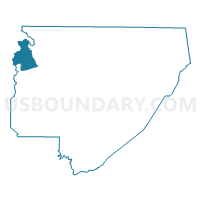
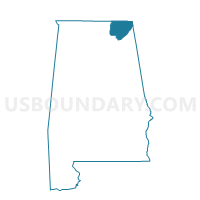
Hambrick Community Center, Jackson County, Alabama
About
Outline

Summary
| Unique Area Identifier | 521989 |
| Name | Hambrick Community Center |
| County | Jackson County |
| State | Alabama |
| Area (square miles) | 23.83 |
| Land Area (square miles) | 23.82 |
| Water Area (square miles) | 0.01 |
| % of Land Area | 99.96 |
| % of Water Area | 0.04 |
| Latitude of the Internal Point | 34.86749300 |
| Longtitude of the Internal Point | -86.29984290 |
Maps

Graphs
Select a template below for downloading or customizing gragh for Hambrick Community Center, Jackson County, Alabama


Neighbors
Neighoring Voting District (by Name) Neighboring Voting District on the Map
- Hollytree-Morris's Store, Jackson County, AL
- Hurricane Creek Community Center, Madison County, AL
- New Market Fire Station, Madison County, AL
- Princeton Fire Hall, Jackson County, AL