


Edwin Clubhouse, Henry County, Alabama
About
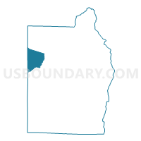
Outline

Summary
| Unique Area Identifier | 521918 |
| Name | Edwin Clubhouse |
| County | Henry County |
| State | Alabama |
| Area (square miles) | 17.24 |
| Land Area (square miles) | 17.24 |
| Water Area (square miles) | 0.00 |
| % of Land Area | 100.00 |
| % of Water Area | 0.00 |
| Latitude of the Internal Point | 31.58329410 |
| Longtitude of the Internal Point | -85.38652910 |
Maps


Graphs
Select a template below for downloading or customizing gragh for Edwin Clubhouse, Henry County, Alabama


Neighbors
Neighoring Voting District (by Name) Neighboring Voting District on the Map
- Abbevile Armory, Henry County, AL
- Bertha, Dale County, AL
- Blue Springs City Hall, Barbour County, AL
- Capps Post Office, Henry County, AL
- Clopton, Dale County, AL
- Edwin Clubhouse, Henry County, AL
Top 10 Neighboring County Subdivision (by Population) Neighboring County Subdivision on the Map
- Abbeville CCD, Henry County, AL (4,872)
- Clio CCD, Barbour County, AL (4,303)
- Echo CCD, Dale County, AL (2,067)
Top 10 Neighboring Unified School District (by Population) Neighboring Unified School District on the Map
- Henry County School District, AL (17,297)
- Dale County School District, AL (15,572)
- Barbour County School District, AL (14,320)
Top 10 Neighboring State Legislative District Lower Chamber (by Population) Neighboring State Legislative District Lower Chamber on the Map
- State House District 89, AL (44,249)
- State House District 85, AL (42,429)
- State House District 84, AL (41,317)
Top 10 Neighboring State Legislative District Upper Chamber (by Population) Neighboring State Legislative District Upper Chamber on the Map
Top 10 Neighboring 111th Congressional District (by Population) Neighboring 111th Congressional District on the Map
Top 10 Neighboring Census Tract (by Population) Neighboring Census Tract on the Map
- Census Tract 9504, Barbour County, AL (4,303)
- Census Tract 202, Dale County, AL (2,067)
- Census Tract 301, Henry County, AL (1,910)