


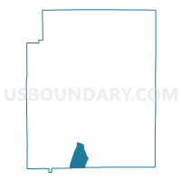
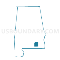
Fairview, Coffee County, Alabama
About
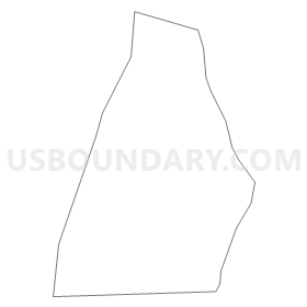
Outline
Summary
| Unique Area Identifier | 521452 |
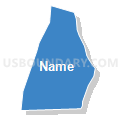
| Name | Fairview |
| County | Coffee County |
| State | Alabama |
| Area (square miles) | 10.04 |
| Land Area (square miles) | 10.01 |
| Water Area (square miles) | 0.04 |
| % of Land Area | 99.62 |
| % of Water Area | 0.38 |
| Latitude of the Internal Point | 31.21656070 |
| Longtitude of the Internal Point | -86.02839140 |
Maps

Graphs
Select a template below for downloading or customizing gragh for Fairview, Coffee County, Alabama


Neighbors
Neighoring Voting District (by Name) Neighboring Voting District on the Map
- Goodman, Coffee County, AL
- Holly's Store, Coffee County, AL
- Ino Community, Coffee County, AL
- Piney Grove-Samson Legion Hall-Samson Comm Center Voting District, Geneva County, AL
Top 10 Neighboring County Subdivision (by Population) Neighboring County Subdivision on the Map
- Samson CCD, Geneva County, AL (5,098)
- Bellwood-Coffee Springs CCD, Geneva County, AL (2,323)
- Goodman CCD, Coffee County, AL (2,286)
Top 10 Neighboring Unified School District (by Population) Neighboring Unified School District on the Map
Top 10 Neighboring State Legislative District Lower Chamber (by Population) Neighboring State Legislative District Lower Chamber on the Map
Top 10 Neighboring State Legislative District Upper Chamber (by Population) Neighboring State Legislative District Upper Chamber on the Map
Top 10 Neighboring 111th Congressional District (by Population) Neighboring 111th Congressional District on the Map
Top 10 Neighboring Census Tract (by Population) Neighboring Census Tract on the Map
- Census Tract 501, Geneva County, AL (5,098)
- Census Tract 502, Geneva County, AL (2,323)
- Census Tract 107, Coffee County, AL (2,286)