


Lawley Comm Center-7, Bibb County, Alabama
About
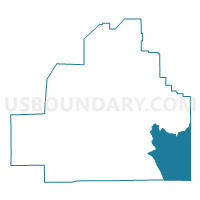
Outline

Summary
| Unique Area Identifier | 521231 |
| Name | Lawley Comm Center-7 |
| County | Bibb County |
| State | Alabama |
| Area (square miles) | 53.57 |
| Land Area (square miles) | 53.46 |
| Water Area (square miles) | 0.10 |
| % of Land Area | 99.81 |
| % of Water Area | 0.19 |
| Latitude of the Internal Point | 32.89557890 |
| Longtitude of the Internal Point | -86.93390480 |
Maps


Graphs
Select a template below for downloading or customizing gragh for Lawley Comm Center-7, Bibb County, Alabama


Neighbors
Neighoring Voting District (by Name) Neighboring Voting District on the Map
- Isabella Fire Station, Chilton County, AL
- Lawley Comm Center-8, Bibb County, AL
- Maplesville Fire Station, Chilton County, AL
- Mars Hill, West Chilton Fire Station, Chilton County, AL
- Rock Building-5, Bibb County, AL
- Six Mile Comm Center-6, Bibb County, AL
Top 10 Neighboring County Subdivision (by Population) Neighboring County Subdivision on the Map
- Jemison CCD, Chilton County, AL (14,242)
- Centreville-Brent CCD, Bibb County, AL (12,937)
- Maplesville CCD, Chilton County, AL (2,902)
Top 10 Neighboring Unified School District (by Population) Neighboring Unified School District on the Map
Top 10 Neighboring State Legislative District Lower Chamber (by Population) Neighboring State Legislative District Lower Chamber on the Map
- State House District 49, AL (52,014)
- State House District 42, AL (48,338)
- State House District 72, AL (39,414)
Top 10 Neighboring State Legislative District Upper Chamber (by Population) Neighboring State Legislative District Upper Chamber on the Map
Top 10 Neighboring 111th Congressional District (by Population) Neighboring 111th Congressional District on the Map
Top 10 Neighboring Census Tract (by Population) Neighboring Census Tract on the Map
- Census Tract 604.02, Chilton County, AL (8,776)
- Census Tract 100.03, Bibb County, AL (5,391)
- Census Tract 605, Chilton County, AL (2,902)