


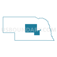
Central Nebraska PUMA, Nebraska
About
Outline

Summary
| Unique Area Identifier | 193328 |
| Name | Central Nebraska PUMA |
| State | Nebraska |
| Area (square miles) | 8,890.49 |
| Land Area (square miles) | 8,846.73 |
| Water Area (square miles) | 43.76 |
| % of Land Area | 99.51 |
| % of Water Area | 0.49 |
| Latitude of the Internal Point | 41.45028570 |
| Longtitude of the Internal Point | -99.06041230 |
Maps

Graphs
Select a template below for downloading or customizing gragh for Central Nebraska PUMA, Nebraska


Neighbors
Neighoring Public Use Microdata Area (by Name) Neighboring Public Use Microdata Area on the Map
- North Central & Northwest Nebraska PUMA, NE
- Northeast Nebraska PUMA, NE
- South Central Nebraska PUMA, NE
- Southeast Nebraska PUMA, NE
- Southwest Nebraska PUMA, NE
Top 10 Neighboring County (by Population) Neighboring County on the Map
- Hall County, NE (58,607)
- Buffalo County, NE (46,102)
- Lincoln County, NE (36,288)
- Platte County, NE (32,237)
- Adams County, NE (31,364)
- Dawson County, NE (24,326)
- York County, NE (13,665)
- Custer County, NE (10,939)
- Holt County, NE (10,435)
- Hamilton County, NE (9,124)
Top 10 Neighboring County Subdivision (by Population) Neighboring County Subdivision on the Map
- Grand Island city, Hall County, NE (48,520)
- Precinct 4, Hamilton County, NE (4,171)
- Broken Bow city, Custer County, NE (3,559)
- Central City city, Merrick County, NE (2,934)
- Ord township, Valley County, NE (2,487)
- St. Paul city, Howard County, NE (2,290)
- Washington township, Hall County, NE (1,869)
- Wood River township, Hall County, NE (1,641)
- Shelton township, Buffalo County, NE (1,365)
- Henderson precinct, York County, NE (1,215)
Top 10 Neighboring Place (by Population) Neighboring Place on the Map
- Grand Island city, NE (48,520)
- Aurora city, NE (4,479)
- Broken Bow city, NE (3,559)
- Central City city, NE (2,934)
- St. Paul city, NE (2,290)
- Ord city, NE (2,112)
- Wood River city, NE (1,325)
- Burwell city, NE (1,210)
- Shelton village, NE (1,059)
- Loup City city, NE (1,029)
Top 10 Neighboring Unified School District (by Population) Neighboring Unified School District on the Map
- Grand Island Public Schools, NE (48,267)
- Columbus Public Schools, NE (23,264)
- Lexington Public Schools, NE (12,327)
- Aurora Public Schools, NE (6,666)
- Northwest Public Schools, NE (5,807)
- Adams Central Public Schools, NE (5,278)
- Cozad City Schools, NE (5,227)
- Broken Bow Public Schools, NE (4,934)
- Central City Public Schools, NE (4,655)
- Gothenburg Public Schools, NE (4,528)
Top 10 Neighboring State Legislative District Upper Chamber (by Population) Neighboring State Legislative District Upper Chamber on the Map
- State Senate District 35, NE (39,561)
- State Senate District 36, NE (37,224)
- State Senate District 42, NE (36,288)
- State Senate District 33, NE (35,648)
- State Senate District 22, NE (35,193)
- State Senate District 34, NE (35,089)
- State Senate District 24, NE (34,230)
- State Senate District 41, NE (33,249)
- State Senate District 38, NE (32,734)
- State Senate District 40, NE (31,744)
Top 10 Neighboring 111th Congressional District (by Population) Neighboring 111th Congressional District on the Map
Top 10 Neighboring Census Tract (by Population) Neighboring Census Tract on the Map
- Census Tract 3, Hall County, NE (6,385)
- Census Tract 4, Hall County, NE (5,389)
- Census Tract 2, Hall County, NE (5,070)
- Census Tract 9, Hall County, NE (5,042)
- Census Tract 9691, Buffalo County, NE (4,782)
- Census Tract 10, Hall County, NE (4,754)
- Census Tract 5, Hall County, NE (4,752)
- Census Tract 9693, Hamilton County, NE (4,708)
- Census Tract 9706, Howard County, NE (4,580)
- Census Tract 6, Hall County, NE (4,530)
Top 10 Neighboring 5-Digit ZIP Code Tabulation Area (by Population) Neighboring 5-Digit ZIP Code Tabulation Area on the Map
- 68801, NE (30,005)
- 68601, NE (28,185)
- 68901, NE (26,354)
- 68803, NE (22,560)
- 68850, NE (12,295)
- 68818, NE (5,475)
- 69130, NE (5,307)
- 68822, NE (4,834)
- 69138, NE (4,489)
- 68826, NE (3,955)