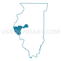
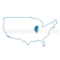
Adams, Pike, Brown, Schuyler & Mason Counties PUMA, Illinois
About
Outline

Summary
| Unique Area Identifier | 192819 |
| Name | Adams, Pike, Brown, Schuyler & Mason Counties PUMA |
| State | Illinois |
| Area (square miles) | 3,032.22 |
| Land Area (square miles) | 2,968.70 |
| Water Area (square miles) | 63.52 |
| % of Land Area | 97.91 |
| % of Water Area | 2.09 |
| Latitude of the Internal Point | 39.95539290 |
| Longtitude of the Internal Point | -90.72572510 |
Maps
Graphs
Select a template below for downloading or customizing gragh for Adams, Pike, Brown, Schuyler & Mason Counties PUMA, Illinois


Neighbors
Neighoring Public Use Microdata Area (by Name) Neighboring Public Use Microdata Area on the Map
- Cass, Morgan, Scott, Greene, Macoupin, Jersey & Calhoun Counties PUMA, IL
- Henry, Mercer, Henderson, Warren, Hancock, McDonough & Fulton Counties PUMA, IL
- Lincoln, Warren, Audrain, Pike & Montgomery Counties PUMA, MO
- Menard, Logan, De Witt, Piatt, Moultrie, Shelby & Christian Counties PUMA, IL
- Northeast Missouri PUMA, MO
- Tazewell County PUMA, IL
Top 10 Neighboring County (by Population) Neighboring County on the Map
- Tazewell County, IL (135,394)
- Adams County, IL (67,103)
- Fulton County, IL (37,069)
- Morgan County, IL (35,547)
- McDonough County, IL (32,612)
- Logan County, IL (30,305)
- Marion County, MO (28,781)
- Hancock County, IL (19,104)
- Pike County, MO (18,516)
- Pike County, IL (16,430)
Top 10 Neighboring County Subdivision (by Population) Neighboring County Subdivision on the Map
- Quincy township, Adams County, IL (40,633)
- Mason township, Marion County, MO (13,438)
- Beardstown township, Cass County, IL (6,983)
- Miller township, Marion County, MO (5,997)
- Melrose township, Adams County, IL (5,746)
- Buffalo township, Pike County, MO (5,176)
- Havana township, Mason County, IL (4,816)
- Mount Sterling township, Brown County, IL (4,673)
- Liberty township, Marion County, MO (4,500)
- Pittsfield township, Pike County, IL (4,477)
Top 10 Neighboring Place (by Population) Neighboring Place on the Map
- Quincy city, IL (40,633)
- Hannibal city, MO (17,916)
- Pittsfield city, IL (4,576)
- Louisiana city, MO (3,364)
- Havana city, IL (3,301)
- Rushville city, IL (3,192)
- Canton city, MO (2,377)
- Mason City city, IL (2,343)
- Mount Sterling city, IL (2,025)
- Manito village, IL (1,642)
Top 10 Neighboring Elementary School District (by Population) Neighboring Elementary School District on the Map
- New Holland-Middletown Elementary School District 88, IL (1,152)
- Boncl R-X School District, MO (487)
Top 10 Neighboring Secondary School District (by Population) Neighboring Secondary School District on the Map
Top 10 Neighboring Unified School District (by Population) Neighboring Unified School District on the Map
- Quincy School District 172, IL (51,038)
- Hannibal School District, MO (22,813)
- Pikeland Community Unit School District 10, IL (8,636)
- Beardstown Community Unit School District 15, IL (8,052)
- Schuyler-Industry Community Unit School District 5, IL (8,005)
- Porta Community Unit School District 202, IL (7,122)
- Brown County Community Unit School District 1, IL (6,926)
- Palmyra R-I School District, MO (6,736)
- Havana Community Unit School District 126, IL (6,627)
- Lewis County C-1 School District, MO (6,554)
Top 10 Neighboring State Legislative District Lower Chamber (by Population) Neighboring State Legislative District Lower Chamber on the Map
- State House District 100, IL (117,164)
- State House District 87, IL (106,764)
- State House District 91, IL (105,176)
- State House District 93, IL (103,943)
- State House District 97, IL (103,784)
- State House District 94, IL (100,005)
- State House District 6, MO (35,970)
- State House District 10, MO (35,091)
- State House District 1, MO (33,818)
Top 10 Neighboring State Legislative District Upper Chamber (by Population) Neighboring State Legislative District Upper Chamber on the Map
- State Senate District 44, IL (225,390)
- State Senate District 50, IL (218,180)
- State Senate District 49, IL (207,061)
- State Senate District 47, IL (203,948)
- State Senate District 46, IL (202,849)
- State Senate District 18, MO (159,547)
Top 10 Neighboring 111th Congressional District (by Population) Neighboring 111th Congressional District on the Map
- Congressional District 9, MO (684,101)
- Congressional District 18, IL (665,723)
- Congressional District 17, IL (634,792)
Top 10 Neighboring Census Tract (by Population) Neighboring Census Tract on the Map
- Census Tract 11, Adams County, IL (7,257)
- Census Tract 101, Menard County, IL (6,139)
- Census Tract 103, Adams County, IL (5,890)
- Census Tract 106, Adams County, IL (5,875)
- Census Tract 9535, Logan County, IL (5,575)
- Census Tract 9527, Pike County, IL (4,762)
- Census Tract 219, Tazewell County, IL (4,677)
- Census Tract 1, Adams County, IL (4,627)
- Census Tract 9604, Marion County, MO (4,510)
- Census Tract 101, Adams County, IL (4,451)
Top 10 Neighboring 5-Digit ZIP Code Tabulation Area (by Population) Neighboring 5-Digit ZIP Code Tabulation Area on the Map
- 62301, IL (33,758)
- 61455, IL (22,086)
- 63401, MO (22,067)
- 62305, IL (18,052)
- 62618, IL (7,955)
- 62363, IL (6,353)
- 62675, IL (6,154)
- 63461, MO (5,876)
- 62353, IL (5,637)
- 62681, IL (5,602)


